| Date | Location | Start Times | Courses | Cost |
| 12 Apr | Settlers Cabin Park, Algonquin | 11 am to 2 pm First WPOC event for this park | Beginner; Novice; Intermediate; Advanced short and long | $6 per map* |
If you are planning to come to this event, please preregister at
http://www.wpoc.org/preregistration.php
Preregistration Deadline: 11:59 pm 09 Apr
Preregistration does not involve paying any money until you come to the event. Also, the cost is waived for preregistered kids; so they are free.
Anyone who is NOT preregistered (including kids) pays $1 more than the normal cost and is NOT guaranteed a preprinted map.
Each preregistered person/group is guaranteed one preprinted map. If a group wants multiple maps, it should preregister in pieces.
If you would like to find out more, go to our Web site www.wpoc.org
Or call Jim Wolfe at 814 255-6606 or e-mail jlwolfe@atlanticbb.net
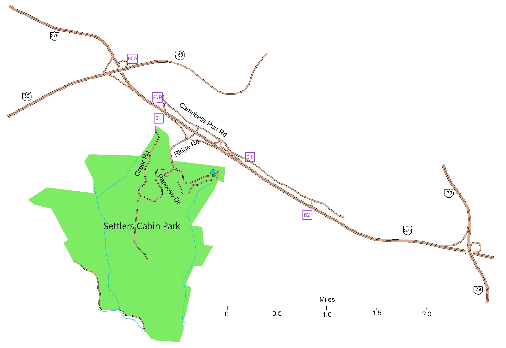
From the East on 376 (the parkway): Take 376 West to exit 60B toward Crafton for 0.1 mi.
Trun Right on Campbells Run Rd and go for 0.4 mi. Turn Right on Ridge Rd and go for 0.5 mi.
Turn Right on Papoose Dr, go for 100 ft and turn left into the parking for the Algonquin shelter.
From the North or South on I79: Exit onto 376 West and follow the directions above.
From the West on 376 (the parkway): Take 376 East to exit 61 toward Ridge Rd.
Follow that for 0.2 mi; then make a slight Right to stay on Ridge Rd for another 0.3 mi.
Turn Right on Papoose Dr, go for 100 ft and turn left into the parking for the Algonquin shelter.
From the West on Route 30: Exit onto 376 East and follow the directions above.
Here is a Google maps
link to the Algonquin Shelter
The GPS coordinates of the Algonquin Shelter are 40.433611 N, 80-157778 W