| Date | Location | Start Times | Courses | Cost |
| 31 Dec | , | ; click here to see details |
If you would like to find out more, go to our Web site www.wpoc.org
Or call Jim Wolfe at 814 255-6606 or e-mail jlwolfe@atlanticbb.net
PREREGISTRATION FOR THIS EVENT IS REQUIRED Preregister at http://www.wpoc.org/registerminirogaine.php?revent=Babcock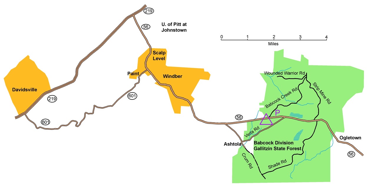
From the intersection of Route 219 and Route 56 East of Johnstown, follow Route 56 East for 7.8 miles to the Babcock picnic area (on the right, where the map shows a purple triangle). There is some parking in the picnic area and a larger parking lot on the other side of Route 56 where the purple P is on the map. There will be red and white orienteering signs at the entrance to the picnic area and at the entrance to the parking area.
Some suggestions to reach the intersection of Route 219 and Route 56 mentioned above:
From the Pittsburgh area, take the PA turnpike east to exit 110 in Somerset. Then take Route 281 to Route 219 and go north.
Or take Route 22 east to Armagh. Then take Route 56 East from there through Johnstown to Route 219. Stay on Route 56 East.
Or take Route 30 east past Jennerstown to Route 219. Then, go north on Route 219.
From the Indiana or Altoona area, take Route 56 East from Armagh or take Route 219 South from Ebensburg.
From the East on the PA turnpike (Route 76), take the Bedford Exit to Route 99 and go North for 3 miles, then go West on Route 56 for 24 miles.
Here is a Google maps link to the entrance to the Babcock Picnic area
The GPS coordinates of the picnic area are 40.215679 N, 78.763344 W